 |
Lightning DetectionNWA Remote Sensing Committee |
|---|
|
Lightning DetectionNWA Remote Sensing Committee |
|---|
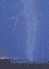
Lightning is the second highest cause of weather-related deaths in the United States annually, and produces considerable damage by initiating fires and disrupting communications and power transmission systems. Remote sensing technology is becoming increasingly important in the detection of lightning-producing convective storms. The National Lightning Data Network (NLDN), operated by Vaisala, Inc., provides continuous cloud-to-ground lightning strike data to a variety of government, commercial, and public users. Other ground-based time of arrival type networks include the U. S. Precision Lightning Network, Inc., operated by WSI, Inc., and the Earth Networks Total Lightning Network, which observes both in-cloud and cloud-to-ground strikes.
A space-based Lightning Imaging Sensor (LIS), developed by NASA Marshall Space Flight Center, is flown on the Tropical Rainfall Measuring Mission (TRMM) satellite. A Geostationary Lightning Mapper (GLM) was implemented on GOES-R/16, launched in November, 2016, as recommended by the NWA.
![]()
Listed below are some resources that provide useful information on lightning, including remote sensing capabilities:
![]() General Information
General Information
![]() Lightning Research
Lightning Research
![]() Realtime Lightning Strike Information
Realtime Lightning Strike Information
![]() Lightning Forecasts
Lightning Forecasts
![]() Lightning Safety
Lightning Safety
![]() Papers of Note
Papers of Note![]()
![]() Commercial Lightning Systems and Services (For information only; not an endorsement by the NWA)
Commercial Lightning Systems and Services (For information only; not an endorsement by the NWA)
![]() NWA Remote Sensing Committee HomePage | Satellites | Radar
NWA Remote Sensing Committee HomePage | Satellites | Radar